-
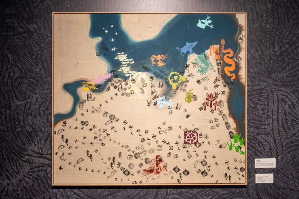 Place Names Melville map at the Doontanboro Kura exhibition, Wireless Hill Museum - Hugh Sando
GALLERY
Place Names Melville Interactive Map
Melville
The large linen map featured in 'Doontanboro Kura: Melville Waters Dreaming' exhibition showcases the locations of three Noongar placenames decoded during Phase I of the Place Names Melville project, and the 14 names decoded in Phase II.
the map's creation began in 2022, with the Beeliar (river) painted and the first three placenames – Goolugatup, Jenalup and Willagee – riso-printed on the canvas. In Phase II, a backdrop of symbols representing the tangible and intangible elements of Country in the Melville area were added. These symbols were printed using tiny Basque clay stamps created by the contributing artists, guided by lead artist Natalie Scholtz.
A symbol for each of the decoded placenames was chosen by popular vote, enlarged and riso-printed onto the map with the support of emerging Noongar artist Zali Morgan. While the visible layers include the Beeliar, clay stamp symbols and placename icons, the map also holds many invisible layers – conversations and stories shared throughout the project, connecting to the millennia-long presence of Noongar people on this boodja.
The map was then turned into an interactive one which includes the explanations and recordings of the decoded placenames.
Close
The large linen map featured in 'Doontanboro Kura: Melville Waters Dreaming' exhibition showcases the locations of three Noongar placenames decoded during Phase I of the Place Names Melville project, and the 14 names decoded in Phase II.
the map's creation began in 2022, with the Beeliar (river) painted and the first three placenames – Goolugatup, Jenalup and Willagee – riso-printed on the canvas. In Phase II, a backdrop of symbols representing the tangible and intangible elements of Country in the Melville area were added. These symbols were printed using tiny Basque clay stamps created by the contributing artists, guided by lead artist Natalie Scholtz.
A symbol for each of the decoded placenames was chosen by popular vote, enlarged and riso-printed onto the map with the support of emerging Noongar artist Zali Morgan. While the visible layers include the Beeliar, clay stamp symbols and placename icons, the map also holds many invisible layers – conversations and stories shared throughout the project, connecting to the millennia-long presence of Noongar people on this boodja.
The map was then turned into an interactive one which includes the explanations and recordings of the decoded placenames.


